Road Safety
- Publication no: AP-R587-19
- ISBN: 978-1-925671-83-4
- Published: 4 March 2019
- PDF (free) Download
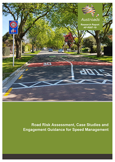
Inappropriate or excessive speed is a major road safety issue. Effective speed management is fundamental and critical to reducing speed-related road trauma.
Speed limit setting is at the core of speed management. Speed limits need to be set at a safe and appropriate level, considering the function, design and safety of the road. Infrastructure Risk Rating (IRR), initially developed in New Zealand, is a simple road assessment methodology designed to assess road safety risk at a network level, primarily as an input to the speed limit setting process. This report explores IRR in some detail, with particular emphasis on how it may be used by State and Local governments in Australia to inform speed management on their road networks.
This report includes several case studies demonstrating speed management interventions that were successfully applied in Australia and New Zealand.
The report also identifies good practice guidance for engagement and consultation to effectively implement speed management interventions
- Summary
- Acronyms and Abbreviations
- 1. Introduction
- 1.1 Research Objectives
- 1.2 Structure of this Report
- 2. Literature Review
- 2.1 Speed and the Safe System Philosophy
- 2.2 Speed Limit Setting Approaches
- 2.2.1 Engineering (85th percentile) Approach
- 2.2.2 Expert System Approach
- 2.2.3 Optimisation Approach
- 2.2.4 Netherlands Safe and Credible Speed Limits (SaCredSpeed)
- 2.2.5 New Zealand Speed Management Framework
- 2.2.6 Model National Guidelines for Setting Speed Limits at High Risk Locations
- 2.3 Infrastructure Risk Assessment
- 2.3.1 Star Rating
- 2.3.2 Infrastructure Risk Rating
- 2.3.3 Roadside Hazard Measures
- 2.4 Summary
- 3. Infrastructure Risk Rating Methodology
- 3.1 Background
- 3.2 Risk Attributes and Scoring
- 3.3 Identifying Sections for Coding
- 3.4 Streamlined Process
- 3.4.1 Input Datasets
- 3.4.2 Road Segmentation Process
- 3.4.3 Assumptions
- 3.4.4 Validation
- 3.5 IRR within the Speed Management Framework
- 3.5.1 Determining Safe and Appropriate Speeds
- 3.6 Queensland IRR Assessment
- 3.7 Victoria IRR Assessment
- 3.8 Potential IRR Refinements
- 3.8.1 Pedestrian and Cycle Infrastructure
- 3.8.2 Traffic Volume
- 4. Infrastructure Risk Rating Trials
- 4.1 Trial Scoping
- 4.1.1 Posted or Operating Speed
- 4.1.2 Pedestrians and Cyclists
- 4.1.3 Network Operating Framework
- 4.2 IRR Methodology for Australian Trial Sites
- 4.3 Trial Results and Evaluation
- 4.3.1 Mornington Peninsula
- 4.3.2 Tasmania
- 4.3.3 Port Macquarie-Hastings
- 4.3.4 Western Australia
- 4.4 Australian IRR Trial Summary
- 4.5 IRR Trial Conclusions
- 4.1 Trial Scoping
- 5. Speed Management Trials and Recommendations
- 5.1 Application of New Zealand Speed Management Framework
- 5.1.1 Mornington Peninsula
- 5.1.2 Tasmania
- 5.1.3 Port Macquarie-Hastings
- 5.1.4 Western Australia
- 5.2 Network Operating Frameworks in Speed Management
- 5.2.1 Using a NOP’s Place Function to Inform IRR Land Use
- 5.2.2 Alignment of Safe and Appropriate Speed with NOP Place Function
- 5.1 Application of New Zealand Speed Management Framework
- 6. IRR Web Tool
- 7. Speed Management Case Studies
- 7.1 Hamilton Safer Speed Areas
- 7.2 Waikato Speed Demonstration
- 7.3 Rural Intersection Active Warning System
- 7.4 Queensland Camera Detected Offence Program
- 7.5 Raised Safety Platform Trial
- 7.6 Peninsula SaferSpeeds Project
- 7.7 Brisbane Portable Warning Signs Program
- 7.8 Advisory Intelligent Speed Adaptation
- 7.9 Queensland Black Links
- 7.10 Now 100 Speed Limit Changes South Australia
- 7.11 Weather Activated Variable Speed Limits
- 7.12 NSW High Pedestrian Activity Areas Program
- 8. Engagement and Consultation Strategies
- 8.1 Existing Guidelines
- 8.1.1 Australian National Road Safety Action Plan 2018-2020
- 8.1.2 Victoria
- 8.1.3 New Zealand
- 8.2 Current Engagement and Consultation Practice
- 8.2.1 Current Speed Management Engagement and Consultation Requirements
- 8.2.2 Resources to Support Speed Management Engagement and Consultation
- 8.2.3 Challenges Regarding Speed Management Engagement and Consultation
- 8.2.4 Undertaking Community Engagement Prior to Speed Limit Changes
- 8.2.5 Responsibility of Engaging with Public on Speed Management
- 8.2.6 Specific Examples of Speed Management Engagement and Consultation
- 8.3 Engagement and Consultation Learnings from Speed Management Case Studies
- 8.4 Summary
- 8.1 Existing Guidelines
- 9. Conclusions and Recommendations
- 9.1 Application of Infrastructure Risk Rating in Australia
- 9.2 Good Practice in Speed Management
- 9.3 Engagement and Consultation Strategies
- 9.4 Recommendations
- References
- Appendix A IRR Manual
- A.1 Coding of IRR Attributes
- A.1.1 Coding Sources
- A.1.2 Definition of a Divided Road
- A.1.3 Identifying Sections for Coding
- A.1.4 Urban Street Cluster
- A.1.5 Road Stereotype
- A.1.6 Alignment
- A.1.7 Carriageway Width
- A.1.8 Roadside Hazards
- A.1.9 Land Use
- A.1.10 Intersection and Access Density
- A.1.11 Traffic Volume
- A.1.12 Speed Limit
- A.2 IRR Model
- A.1 Coding of IRR Attributes
- Appendix B Modifying the IRR Model
- B.1 Modifying IRR Attributes
- B.2 Modifying IRR Risk Bands