Road Safety
- Publication no: AP-R611-20
- ISBN: 978-1-925854-71-8
- Published: 4 February 2020
- PDF (free) Download
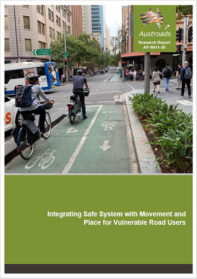
The Movement and Place Framework is increasingly used to guide transport planning in delivering a more integrated transport system to improve customer outcomes and support a range of user groups. Work is already underway in some jurisdictions to integrate Safe System principles and treatments within the Movement and Place Framework to safely cater for all road users and enable more proactive and lasting road safety benefits. This is particularly important for the liveability of places and vibrant streets, where greater numbers of pedestrians and cyclists gather. They are inherently more vulnerable in crashes and, in some environments, highly exposed to the risk of crashes.
This project has developed guidance for Australasian jurisdictions in ensuring, or transitioning to, safe use of roads and streets by pedestrians and cyclists. Road designers and system operators are encouraged to apply the guidance when designing new or redesigning existing roads and streets, and when making decisions about how these roads and streets will operate. The integration of Safe System aligned road elements for walking and cycling into the Movement and Place Framework aims to eventually eliminate deaths and serious injuries to pedestrians and cyclists on Australasian roads.
- Summary
- 1. Introduction
- 1.1 Background
- 1.2 Methodology
- 1.3 Report Structure
- 2. Defining Movement and Place
- 2.1 Key Movement and Place Stereotypes for Pedestrians and Cyclists
- 2.2 Prioritising Modes
- 3. Safe System
- 3.1 The Safe System Approach to Road Safety
- 3.1.1 Opening Summary
- 3.1.2 Key Principles
- 3.1.3 The Importance of Speed
- 3.1.4 Road Policing
- 3.1.5 Innovative Mobility Devices
- 3.1.6 The Role of Standards and Guidelines
- 3.2 Assessing Safe System Alignment
- 3.3 Safe System Aligned Measures for Pedestrians and Cyclists
- 3.4 Supporting Treatments for Pedestrians and Cyclists
- 3.4.1 Criteria for Alignment with Safe System
- 3.4.2 Supporting Treatments and 30 km/h Speed Limits
- 3.4.3 Pedestrian Fencing
- 3.4.4 Tactical Urbanism
- 3.1 The Safe System Approach to Road Safety
- 4. Mapping Pedestrian and Cyclist Safety onto the Movement and Place Framework
- 4.1 Basic Approach
- 4.2 City Hubs
- 4.2.1 General Description
- 4.2.2 Key Movements in City Hubs
- 4.2.3 Key Places in City Hubs
- 4.2.4 Safe System Measures for Pedestrians and Cyclists in City Hubs
- 4.2.5 Safe System Priority Treatments
- 4.3 City Streets
- 4.3.1 General Description
- 4.3.2 Key Movements in City Streets
- 4.3.3 Key Places in City Streets
- 4.3.4 Safe System Measures for Pedestrians and Cyclists in City Streets
- 4.3.5 Safe System Priority Treatments
- 4.4 City Places
- 4.4.1 General Description
- 4.4.2 Key Movements in City Places
- 4.4.3 Key Places in City Places
- 4.4.4 Safe System Measures for Pedestrians and Cyclists in City Places
- 4.4.5 Safe System Priority Treatments
- 4.5 Activity Streets and Boulevards
- 4.5.1 General Description
- 4.5.2 Key Movements in Activity Streets and Boulevards
- 4.5.3 Key Places in Activity Streets and Boulevards
- 4.5.4 Safe System Measures for Pedestrians and Cyclists in Activity Streets and Boulevards
- 4.5.5 Safe System Priority Treatments
- 4.6 Movement Corridors and Connectors
- 4.6.1 General Description
- 4.6.2 Key Movements in Movement Corridors and Connectors
- 4.6.3 Key Places in Movement Corridors and Connectors
- 4.6.4 Safe System Measures for Pedestrians and Cyclists on Movement Corridors and Connectors
- 4.6.5 Safe System Priority Treatments
- 4.7 Local Streets
- 4.7.1 General Description
- 4.7.2 Key Movements in Local Streets
- 4.7.3 Key Places in Local Streets
- 4.7.4 Safe System Measures for Pedestrians and Cyclists in Local Streets
- 4.7.5 Safe System Priority Treatments
- 5. Concluding Comments
- 5.1 Guidance for Practitioners on Application
- 5.2 Physical Separation or Lower Travel Speeds
- 5.3 Place-making
- References
- Appendix A Movement and Place Frameworks of Leading Australasian Jurisdictions
- A.1 Victoria
- A.2 New South Wales
- A.3 City of Auckland
- Appendix B Safe System Aligned Measures for Pedestrians and Cyclists
- B.1 At Intersections
- B.1.1 Roundabouts with wombat crossings
- B.1.2 Threshold platforms
- B.1.3 All-way stop signs
- B.1.4 Signalised intersections with ‘Scramble’ phasing with 30 km/h speed limits (or lower)
- B.1.5 Restricted access intersection
- B.1.6 Limit access by mode
- B.1.7 Geo-fencing technology on public transport vehicles
- B.1.8 Raised signalised intersections with 30 km/h ramps (or lower)
- B.1.9 Signalised intersections with 30 km/h platforms (or lower)
- B.1.10 Raised intersections with 10 or 20 km/h ramps
- B.1.11 Protected cyclist intersections
- B.1.12 Signalised ‘Tennis Ball’ intersections with 30 km/h geometry (or lower)
- B.1.13 Signalised roundabout with separate phases for public transport, cyclists and pedestrians
- B.1.14 Grade-separation
- B.2 Between Intersections
- B.2.1 Footpaths
- B.2.2 30 km/h speed limits or lower
- B.2.3 Shared use by cyclists of general traffic lanes (with 30 km/h speed limit or lower)
- B.2.4 Playground zones
- B.2.5 On-road cycle lanes (30 km/h speed limit or lower)
- B.2.6 Wombat crossings (30 km/h or lower platforms)
- B.2.7 Zebra crossings (with 30 km/h speed limits or lower)
- B.2.8 Kerb blisters or road narrowing
- B.2.9 Speed platforms
- B.2.10 Horizontal deflection
- B.2.11 Road narrowing
- B.2.12 Textured or coloured road pavements
- B.2.13 Shared zones
- B.2.14 Fully segregated pedestrian paths
- B.2.15 Separated cycle facilities
- B.2.16 Pedestrian operated signals, zebras or wombats in 30 km/h (or lower) speed limits
- B.2.17 Car-free streets
- B.2.18 Exposure reduction/redirection of through-traffic
- B.2.19 Medians
- B.2.20 Relocation of tram stops from centre of the road to the roadside
- B.2.21 Pedestrian malls
- B.2.22 Grade-separation of pedestrians and cyclists from vehicular traffic
- B.1 At Intersections