Road Safety

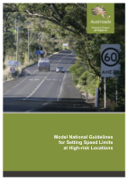
Model National Guidelines for Setting Speed Limits at High-risk Locations
- Publication no: AP-R455-14
- ISBN: 978-1-925037-60-9
- Published: 31 March 2014
- PDF (free) Download
This report incorporates recent research, best practice examples, and jurisdictional inputs to propose a set of model national speed limit guidelines for setting speed limits at high-risk locations. The model guidelines represent a harm reduction approach to speed limits, an intermediate step towards the Safe System.
The model guidelines are intended to apply to different road categories and functions typical to Australia, while incorporating criteria for reduced speed limits based on severe crash risk, such as:
- road lengths that are narrow, have a substantial level of roadside hazards, have many intersections or property entrances, are curvilinear or undulating, or have higher than average severe casualty crash rates
- higher-risk intersections, especially on high-volume outer-urban arterials, where engineering treatments are not feasible.
The model guidelines aim to provide consistent speed limits on roads and intersections which have a higher severe crash risk, while minimising multiple speed zones over short distances.
- 1. Introduction
- 1.1. Background
- 1.2. Objectives
- 1.3. Scope
- 2. Methodology
- 2.1. Literature Review
- 2.2. Consultation and Development of the Guidelines
- 2.3. Trial and Refinement of the Draft Guidelines
- 2.4. Dissemination Plan
- 2.5. Identification of Potential Amendments to Austroads Guides
- 3. Review of Safe System and Risk-based Speed Limits
- 3.1. Safe System Speeds
- 3.2. Speed and Crash Risk
- 3.3. Speed Variation and Crash Risk
- 3.4. Harm Minimisation – The Safe System Approach
- 3.5. Harm Reduction – A Step Towards the Safe System
- 3.5.1. Existing Risk-based Approaches to Speed Limit Setting
- 3.5.2. Option for the Model Guidelines
- 4. Review of Crash Risk Assessment
- 4.1. Methods of Crash Risk Assessment
- 4.2. Severe Crash Risk Factors (Features of Higher-risk Roads)
- 4.3. Examples of Higher-risk Roads
- 5. Review of Current Guidelines for Setting Speed Limits on Higher-Risk Roads
- 5.1. Australian Guidelines
- 5.1.1. Standards Australia
- 5.1.2. Austroads Guidance
- 5.1.3. Roads and Maritime Services, New South Wales
- 5.1.4. VicRoads, Victoria
- 5.1.5. Department of Transport and Main Roads, Queensland
- 5.1.6. Main Roads, Western Australia
- 5.1.7. Department of Planning, Transport and Infrastructure, South Australia
- 5.2. New Zealand Guidelines
- 5.3. International Guidelines
- 5.3.1. United Kingdom
- 5.3.2. Sweden
- 5.3.3. Netherlands
- 5.3.4. Germany
- 5.3.5. USA
- 5.3.6. Season-dependent and Weather-dependent Speed Limits in Europe
- 5.4. Summary
- 6. Examples of Application of Lower Speed Limits on Higher-risk Roads
- 6.1. Pedestrian Activity Areas
- 6.1.1. NSW High-volume Pedestrian Areas
- 6.1.2. Victorian Strip Shopping Centres and Melbourne CBD
- 6.1.3. Brisbane CBD
- 6.1.4. Perth CBD and Northbridge, WA
- 6.1.5. Perth Strip Shopping Centre – Beaufort Street, Mt Lawley, WA
- 6.1.6. Hobart, Tasmania
- 6.1.7. Canberra Retail Areas, ACT
- 6.1.8. Christchurch School Speed Zone Trial, New Zealand
- 6.1.9. City of Hull, UK
- 6.1.10. London, UK
- 6.1.11. Camden High Street, UK
- 6.1.12. Stockholm CBD, Sweden
- 6.2. Rural Roads
- 6.2.1. Rural Highways, Queensland
- 6.2.2. Adelaide Hills, South Australia
- 6.2.3. Great Ocean Road, Victoria
- 6.2.4. Rural Roads in New Zealand
- 6.2.5. Rural Roads in the Netherlands
- 6.3. Freeways/Motorways
- 6.3.1. Managed Motorways Scheme in the UK
- 6.3.2. 120 km/h in United Arab Emirates (UAE)
- 6.3.3. Variable Speed Limit Trial on the A7 Motorway in France
- 6.3.4. Germany
- 6.4. Adverse Weather Conditions
- 6.5. Intersections
- 6.5.1. Queensland
- 6.5.2. Europe
- 6.5.3. Speed Limits at Roundabouts
- 6.6. Summary of Safety Outcomes of Speed Reduction Trials on Higher-risk Roads
- 7. Trial and Finalisation of the Model Guidelines
- 8. Model Guidelines for Setting Speed Limits at Higher-Risk Locations
- 8.1. Background
- 8.2. Application of the Model Guidelines
- 8.3. Recognition of Road Category and Function
- 8.4. Key Factors Indicating Higher Risk of Severe Crashes
- 8.5. Minimising Frequency of Speed Limit Changes
- 8.6. Speed Limit Review Process
- 8.7. Selection of a Risk-based Speed Limit
- 8.8. Localised Speed Limit Reductions at Higher-risk Intersections
- 8.9. Signing of Speed Limits
- 8.10. Speed Management
- 9. Dissemination Plan
- 10. Potential Changes to Austroads Guides
- 10.1. Speed Limits in Austroads Guides
- 10.2. Potential Changes to the Guide to Road Safety – Part 3
- 10.3. Potential Changes to the Guide to Traffic Management – Part 5
- 11. Discussion
- 12. Summary and Conclusions
- References
- Appendix A Compendium of Severe Crash Risk Factors
- A.1 Urban Roads
- A.2 Rural Roads
- Appendix B Review of Severe Crash Risk Factors
- B.1 Crash Rates
- B.2 Pavement Type
- B.3 Traffic Flow
- B.4 Pedestrians
- B.5 Cyclists
- B.6 Abutting Land Use
- B.7 Frequency of Property Entrances and Intersections
- B.8 Median Presence and Width
- B.9 Lane Width
- B.10 Sealed Shoulders
- B.11 Parking Lanes
- B.12 Clear Zones
- B.13 Hazard Density
- B.14 Horizontal Alignment
- B.15 Terrain
- B.16 Intersection Control
- B.17 Other Factors
- Appendix C Examples of Higher-risk Roads
- C.1 High Pedestrian Activity Zones
- C.2 High-volume Outer Urban Arterials
- C.3 Transition Between Speed Environments
- C.4 Tourist or Motorcycle Routes
- C.5 Uncontrolled Rural Intersections
- C.6 At-grade Railway Crossings
- C.7 Narrow Bridges
- C.8 Freeways
- C.9 Rural Unsealed Roads
- Appendix D Access and Intersection Density Assessment
Related publications
WEB-ZRT-24
Latest Road Safety News
