Road Design

- Publication no: AP-R619-20
- ISBN: 978-1-925854-96-1
- Published: 4 August 2020
- Edition: 1.1
- PDF (free) Download
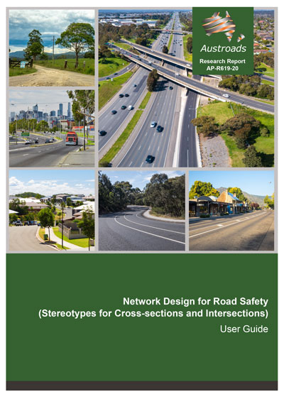
This user guide provides guidance to road managers, planners and designers on achieving improved safety outcomes by applying consistent standards along a road corridor.
Thirteen road stereotype tables were identified covering the road network from rural freeways to urban local access roads.
For each road stereotype, a range of cross-sections was developed with appropriate attributes. Each cross-section was assessed for crash risk using the International Road Assessment Program (iRAP) and the Australian National Risk Assessment Model (ANRAM).
The tables provide guidance on the expected safety performance, or crash risk, of appropriate cross‑section options for each stereotype.
Table users should note that the range of attribute dimensions in the assessment was very limited, so assessment results should be considered as an indication of the safety benefits for the nominated attributes.
This information can be used to develop safety improvement plans on a network/corridor, to achieve overall reductions in crash risk along the network. Network/corridor plans can then be used to inform project scoping decisions.
Edition 1.1 of this report corrects Figure 3.1 Stereotypes overview.
Edition 1.1 corrects Figure 3.1 Stereotypes overview.
- Summary
- 1. Introduction
- 1.1 How to Use these Guidelines
- 1.2 Road Network Hierarchy
- 1.3 Principles for Improving a Road Network
- 1.4 Design Principles
- 1.5 Assessment Methods
- 1.5.1 Star Rating Standard (iRAP)
- 1.5.2 Australian National Risk Assessment Model (ANRAM)
- 1.6 Road Design Competence in the Network-wide Design
- 1.7 Policy Setting
- 2. Network Design Procedure for Road Safety
- 2.1 Step 1: Preliminary Information
- 2.2 Step 2: Collect Data for each Corridor/Link
- 2.3 Step 3: Determine the Road Stereotype
- 2.4 Step 4: Treatment Selection
- 2.5 Step 5: Recommended Corridor Standards
- 3. Road Stereotypes
- 3.1 Summary of Road Stereotypes
- 3.1.1 Intersection Road Stereotypes
- 3.2 Road Stereotypes Description
- 3.1 Summary of Road Stereotypes
- 4. Stereotype Characteristics
- 4.1 Road Function and Movement and Place
- 4.2 Traffic Type and Volumes
- 4.3 Speed Limits
- 4.4 Horizontal Curvature
- 4.5 Assumptions
- 4.5.1 Vertical Grades
- 4.5.2 Property Access
- 4.5.3 Delineation
- 4.5.4 Road Condition
- 4.5.5 Street Lighting
- 4.5.6 Sight Distance
- 5. Mid-block Cross-section Attributes
- 5.1 Formation
- 5.2 Travel Lanes
- 5.3 Shoulders
- 5.4 Bicycle Facilities
- 5.5 Runout Distance
- 5.6 Batter Slopes
- 5.7 Roadside Safety Barriers
- 5.8 Centre/Median Safety Barriers
- 5.9 Wide Centreline
- 5.10 Medians
- 5.11 Audio-tactile Line Marking
- 6. Intersection Types
- 7. Further Support and Feedback
- References
- Appendix A Road Stereotype Tables
- Appendix B Intersection Stereotype Tables
- Appendix C Fatal and Serious Injury Crash Costs
- Appendix D Case Studies
- D.1 Case Study No. 1: Rural Highway, AADT: 8000, Two-lane, Two-way
- D.1.1 Step 1: Preliminary Information Required
- D.1.2 Step 2: Collect the Data for Each Corridor/Link
- D.1.3 Step 3: Determine the Road Stereotype
- D.1.4 Step 4: Analysis of Cross-sections
- D.2 Case Study No. 2: Rural Collector, AADT: 3000, Two-lane, Two-way
- D.2.1 Step 1: Preliminary Information Required
- D.2.2 Step 2: Collect the Data for Each Corridor/Link
- D.2.3 Step 3: Determine the Road Stereotype
- D.2.4 Step 4: Analysis of Cross-sections
- D.3 Case Study No. 3: Network-wide Assessment
- D.3.1 Step 1: Preliminary Information Required
- D.3.2 Step 2: Collect the Data for Each Corridor/Link
- D.3.3 Step 3: Determine the Road Stereotype (ID, FSI and Star Rating).
- D.3.4 Step 4: Treatment Selection
- D.3.5 Step 5: Recommended Corridor Standard
- D.1 Case Study No. 1: Rural Highway, AADT: 8000, Two-lane, Two-way
